
The best practices on the use of water, land and energy resources, as well as the environment of Central Asia
Interactive resource, which accumulates the information on best practices in the use of water, land, and energy, as well as environment in Central Asia.

Key stakeholders in water, energy and land use
The "Key stakeholders in water, energy and land use" database contains information on water management, environmental protection, research, design, river basin organizations, educational institutions, and government bodies in the countries of Eastern Europe, the Caucasus, and Central Asia.

Regional and national projects/programs on water, energy and land use nexus
Database of water, energy and land use nexus projects/programs (ongoing and past) in the Central Asian countries.

WUEMoCA - Water Use Efficiency Monitor in Central Asia
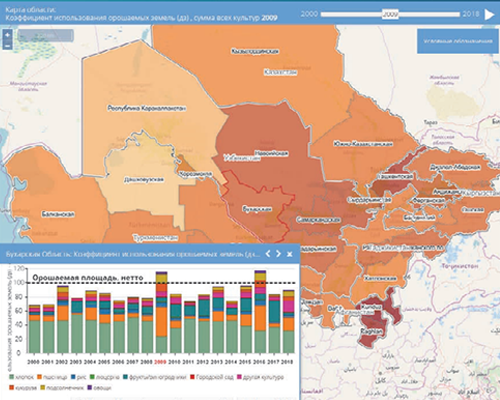
WUEMoCA is a tool which visualizes information on irrigated areas within the contours (oblast, rayon) and yield results of the major crops (cotton, rice, wheat, vegetables, and fruits) based on accessible remote sensing (MODIS 250 m) and meteorological data.
Brochure "Informed Decision-Making in Land and Water Resources Management"

Dams and biodiversity in the mountains of Central Asia
The geo-information system “Dams and Biodiversity in the Mountains of Central Asia” has been developed by the Rivers without Boundaries Coalition. It covers the Aral Sea basin; lakes Issyk-Kul, Balkhash, and Alakol; as well as the river basins of the Tarim, Shu, and Talas.
As of September 1, 2024, the GIS includes data on 300 existing and 200 planned dams—primarily large and medium-sized structures, excluding small irrigation facilities located far from major watercourses. For each dam or reservoir, the system provides information on purpose, dam height, reservoir volume, installed capacity, construction date, and other key parameters.
In addition to hydrotechnical characteristics, the system also includes data on the habitats of rare and endemic fish species and other species sensitive to reservoir development, as well as information on protected areas, Key Biodiversity Areas (KBAs), and lists of endangered flora and fauna found within these KBAs.