|
Project documents
|
Leaflet about project
Minutes of work meeting on the Project (Tashkent, 24 March 2016)
Minutes of workshop on Project (26 October 2016, Tashkent)
Minutes of workshop on Project (29 December 2016, Tashkent)
Minutes of training workshop “Approaches to efficient water resource management by BWO Amudarya and its territorial branches in the context of climate change” (4-5 May, 2017, Urgench)

|
Project publicationts
|
Policy Briefs
Adaptability of the Water Allocation System in the Amudarya River Basin to Changing Conditions (October 2016)
Towards Better Water Management in the Amu Darya River Basin (August 2017)
Towards Strategic Planning of Development in the Amu Darya River Basin (August 2017)
Assessment of Amu Darya Basin’s Development in 2020-2055 (October 2017)
Planning Zone Model — an analytical tool for long-term planning (October 2017)
Project “Transboundary water management adaptation in the Amu Darya Basin to climate change uncertainties” Database (October 2017)
Books
The Future of the Amu Darya Basin in the context of Climate Change (Summary)
|
Reports
|
Quarterly Project Summary (October 1 - December 31, 2015)
Quarterly Project Summary (January 1 - March 31, 2016)
Quarterly Project Summary (April 1 - June 30, 2016)
Annual Report (October 1, 2015 - September 30, 2016)
Quarterly Project Summary (October 1 - December 31, 2016)
Quarterly Project Summary (January 1 - March 31, 2017)
Quarterly Project Summary (April 1 - June 30, 2017)
Annual Report (October 1, 2016 - December 11, 2017)
Quarterly Project Summary (October 1 - December 31, 2017)
Final Report (October 1, 2015 - April 30, 2018)
1. Prepararion (planning & design)
1.1 Study of transboundary water management in the basin
1.2 Development of research methodology
1.3.1 Assessment of climatic scenarios
1.3.2. Agricultural product prices (2010-2015)
1.3.2. Agricultural product prices and energy tariffs for 2050
1.3.3. Water and land resources and their use by sector, collector-drainage flow, agricultural production, reservoir and HEPS operation. Entering data into DB. е) GIS
2. Research
2.1 ASBmm adjustment
2.1 ASBmm adjustment
2.1 c) Assessment of water losses in river channel and return flow in Amudarya river reaches - assessment 2010-2014
2.2 Analysis of national development programs (Tajikistan). Study HEPS operation regimes on 2020-2050
2.2 Analysis of national development programs (Turkmenistan)
2.2a. Analysis of long-term strategy (programs) and forecast indicators of agricultural development until 2050 in the planning zones in the Amudarya basin
2.2a. Review of development of economic sectors and forecast of agricultural development of Turkmenistan until 2055 in the planning zones in the Amudarya basin
2.3a Modeling crop water requirements in context of climate change
2.3b Modeling crop water requirements in context of climate change
2.3c Creation of a shape-file of soil map for irrigation zones in the Amudarya River and work with GIS objects of irrigated agriculture under the Project
2.4 Modeling runoff series in light of climate change
2.6 Studying limitations for development: water demands of Afghanistan, aquatic ecosystems in Prearalie and the Aral Sea
2.7 Review of existing legal and institutional framework for transboudary water management
2.7.1 Review of existing legal and institutional framework for transboudary water management in the Amudarya Basin
2.7.2 Review of legal and institutional framework for transboundary water management in context of climate change: global water conventions, experiences from other countries and regions
2.8.1 Model of planning zone. Module for calculation of irrigated agriculture output and foodstuff
2.8.2 Database and interface
2.8.3 Testing the module for calculation of foodstuff in planning zone model
2.8.3 Testing of the planning zone model
3. Numerical experiment
3.1. Conduct series of simulation for different scenarios for 2016-2055
3.1, 3.2. Numerical experiments
3.1. Series of simulation for different scenarios over 2016-2055
3.1. Creation of a shape-file of soil map for irrigation zones in the Amudarya River and work with GIS objects of irrigated agriculture under the Project
3.1.1.3. Improving the ASBmm river model interface
3.1.2.8. Improving the ASBmm PZ model interface and integration of PZ model
3.1.2.2. Studying the positive effect of climate change in the basin through shortened period of plant growing
3.2. Developing proposals on water management in the context of climate change
3.1.2.3. Scenario-based calculations of crop water requirements in the context of climate change for 2016-2055
3.1.2.7. Optimization methodology, input data, and analysis of results
3.1.2.6. Trends of water demand by economic sector, cropping pattern, and yield for the planning zones based on scenarios for 2016-2055 and taking into account innovations
3.1.2.10 Finalizing planning zone testing for 2010-2015. Calculations of various scenarios for 2016-2055
3.2. Drafting proposals for water management in the context of climate change
3.2. Developing recommendations for BWO Amu Darya territorial divisions (Tajikistan, Turkmenistan, Uzbekistan) on adaptation of water management (planning, analysis) in the context of climate change, potentially increased water consumption by Afghanistan and runoff regulation by HEPS
3.2.1.2. Legal and institutional assessment
4. Dissemination
4 Development of the Database
4.1 Preparing software product
4.1.1 Planning zone model and user manual
4.4. Result presentation and plan of post-project dissemination
4.4. Presenting results and drafting a plan of dissemination
4.4.1. Legal aspects and training

|
Publications
|
Environment and Security in the Amu Darya River Basin (2011)

|
Papers
|
Dukhovny V.A. - Amudarya – the great river in anticipation of momentous decisions (International Summit on "Water and Climate; Meeting of the Great Rivers of the World", 23-25 October 2017, Rome, Italy)
Kurbanbaev S.E. - Climate change and its impacts on Amudarya river runoff
Kurbanbaev E., Kurbanbaev S.E. - Water resources: the basis for the socio-economic development in the lower reaches of the Amudarya: a case study of Karakalpakstan
Ziganshina D. - Adapting to climate change in the Amudarya basin: dealing with droughts… (14th International Conference ”Europe-INBO 2016”, 19-22 October 2016, Lourdes, France)
Ziganshina D. - Historic water allocation in the Amudarya basin: achievements and challenges (Workshop "Water allocation in transboundary basins: A global workshop on the status and good practices", 16-17 October 2017, Geneva, Switzerland)

|
Maps
|
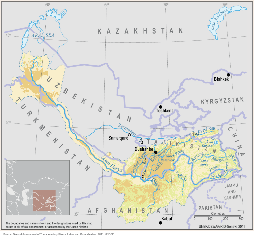
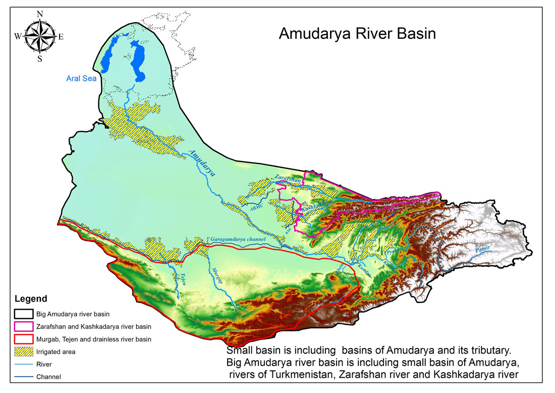
Map of Amudarya river basin
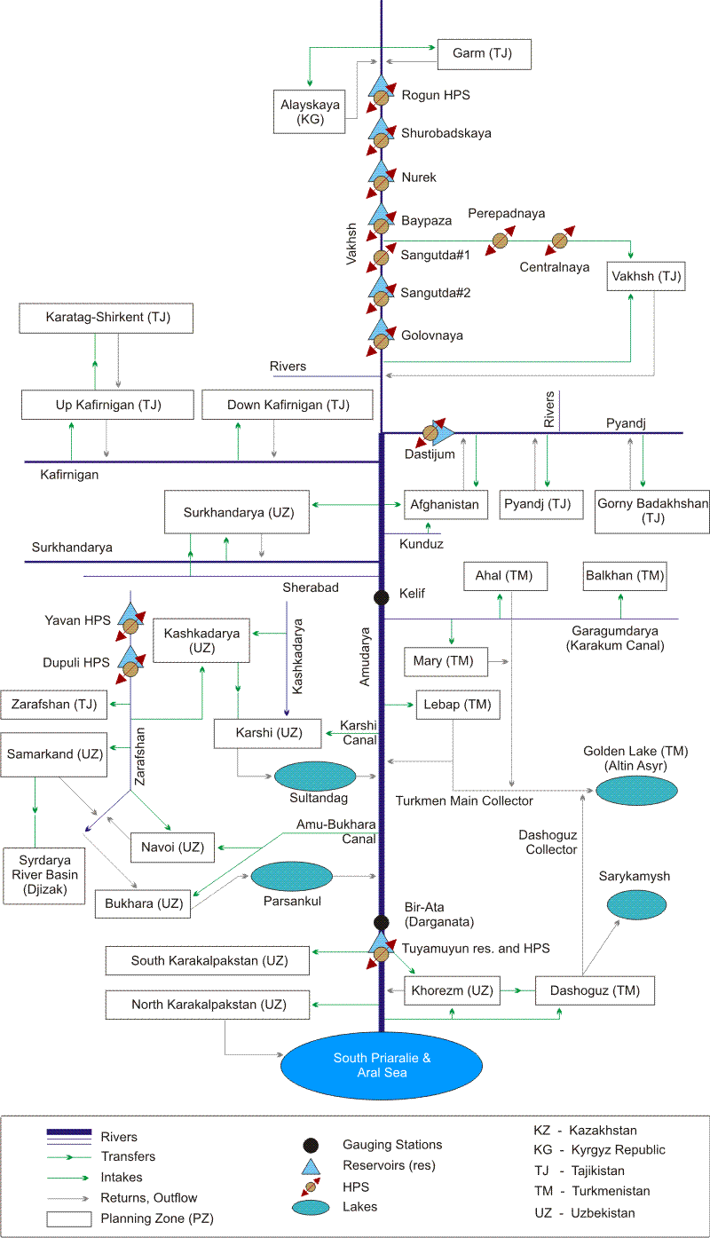
Amudarya's linear scheme: probable scenario and risks
Map of Amudarya river basin
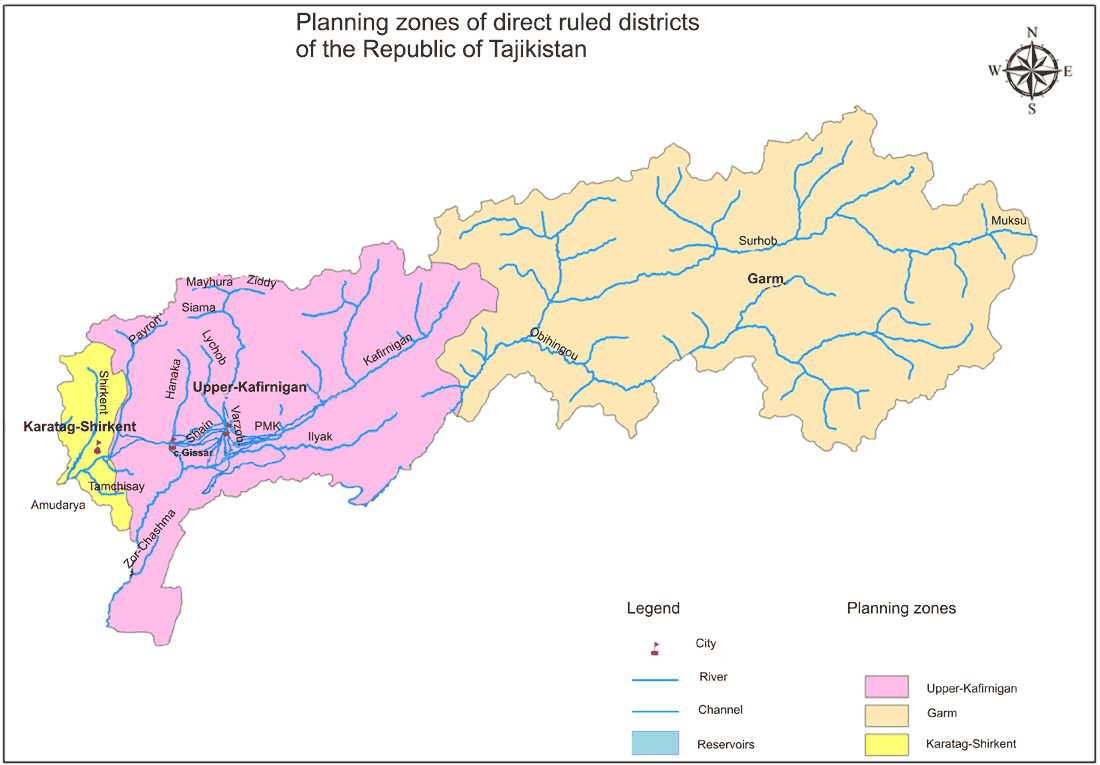
Planning zones in upstream of the Amudarya river basin: Districts of Republican Subordination, Tajikistan
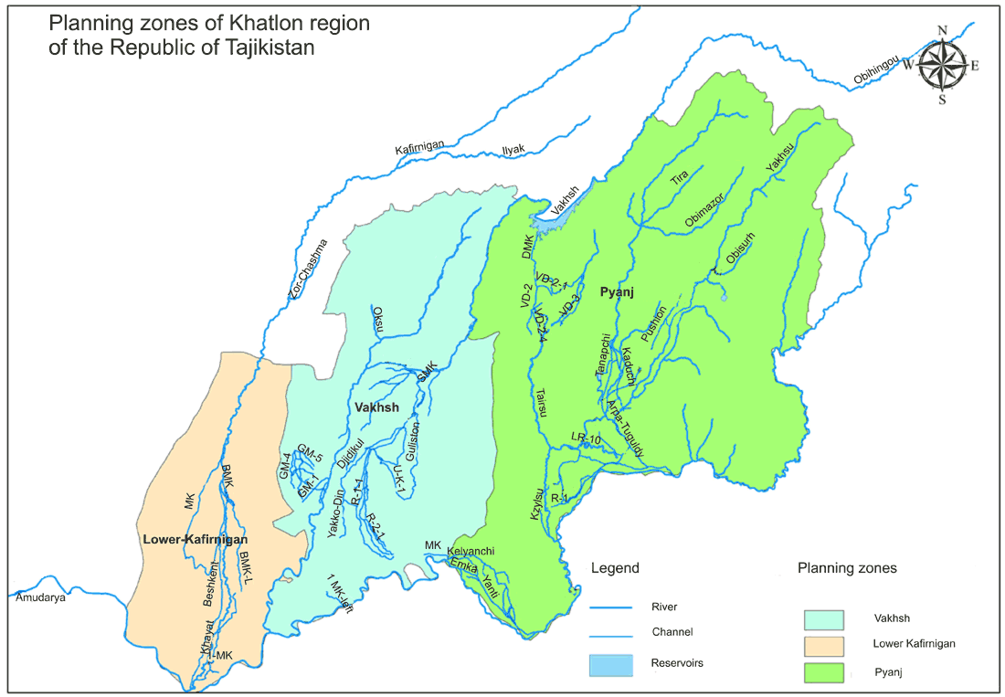
Planning zones in upstream of the Amudarya river basin: Khatlon province, Tajikistan
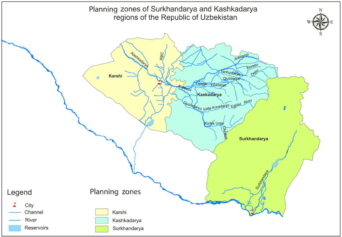
Planning zones in middle stream of the Amudarya river basin: Kashkadarya and Surkhandarya provinces, Uzbekistan
Planning zones in middle stream of the Amudarya river basin: Surkhandarya province, Uzbekistan
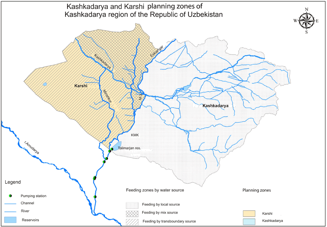
Planning zones in middle stream of the Amudarya river basin: Kashkadarya province, Uzbekistan
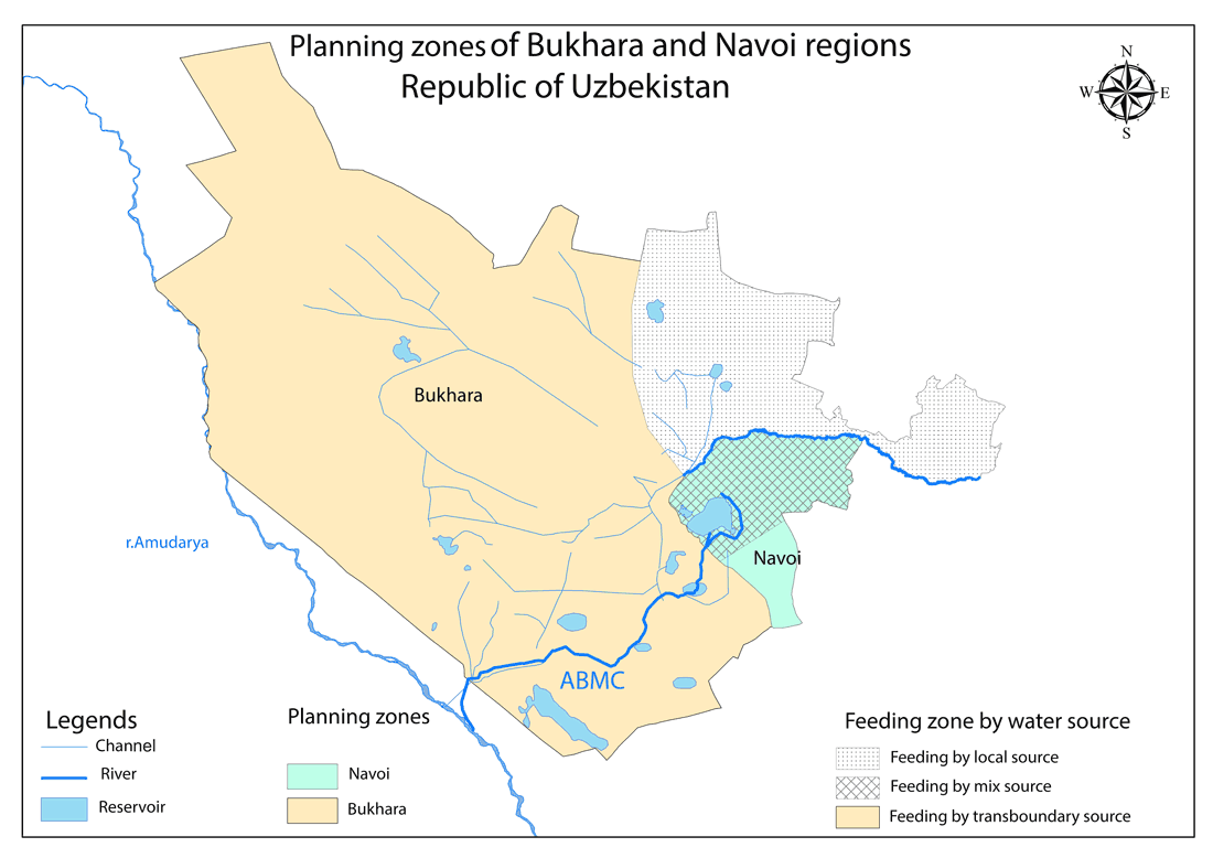
Planning zones in middle stream of the Amudarya river basin: Bukhara and Navoi provinces, Uzbekistan
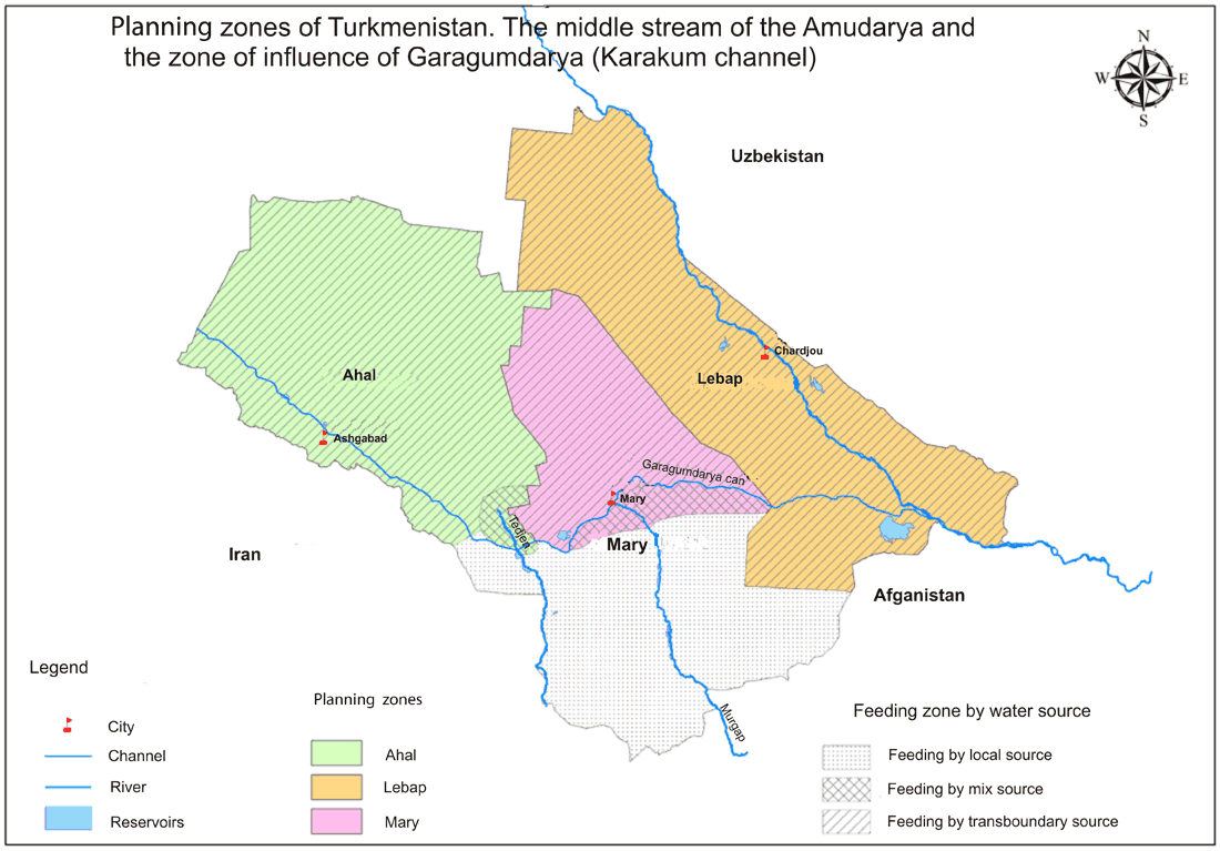
Planning zones in middle stream of the Amudarya river basin: Lebap, Akhal and Mary provinces, Turkmenistan
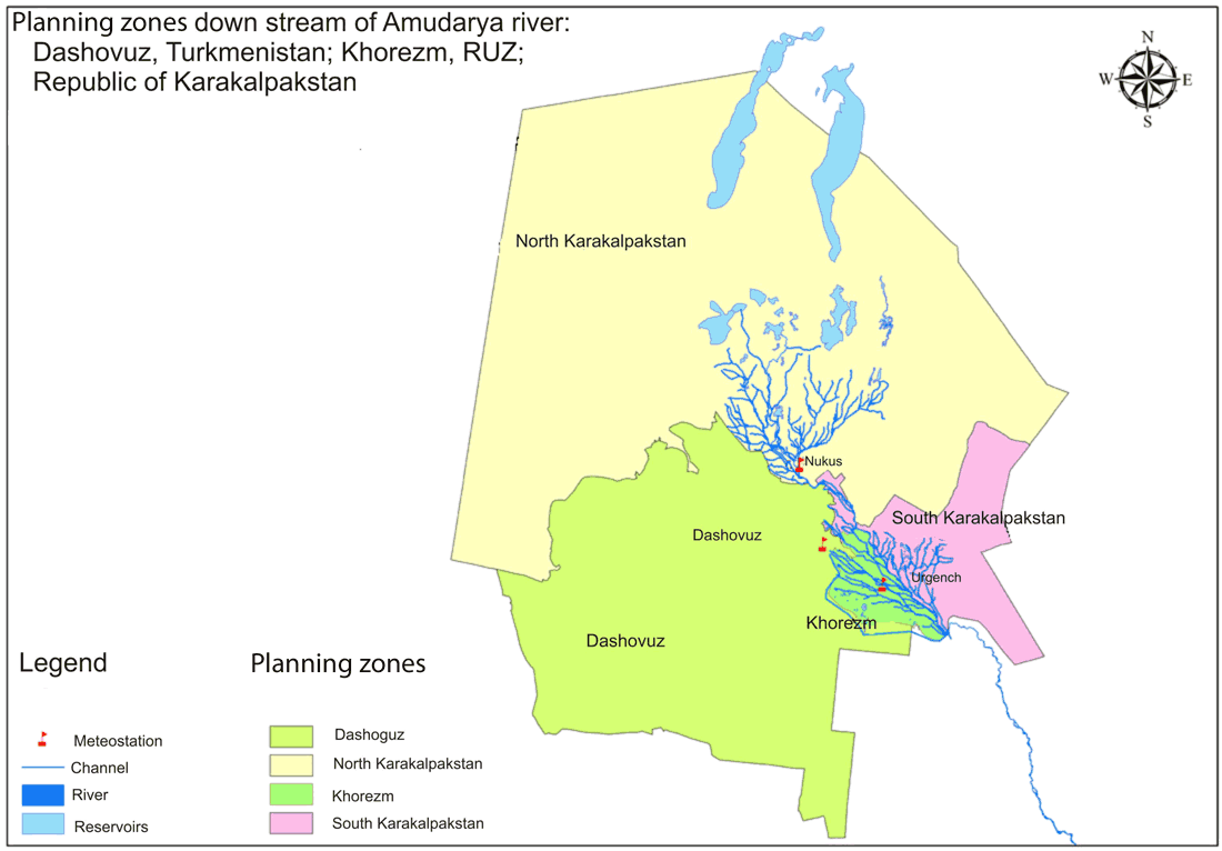
Planning zones in middle stream of the Amudarya river basin: Dashkhovuz province, Turkmenistan; Khorezm province and Karakalpakstan, Uzbekistan
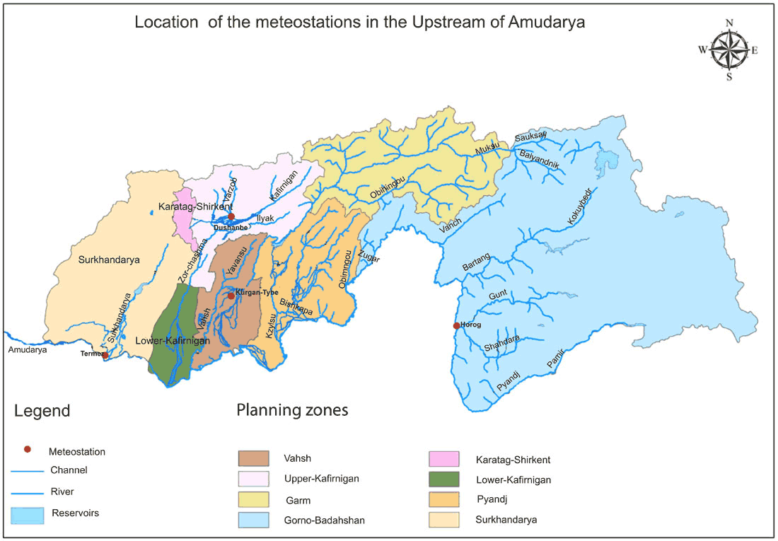
Location of meteostations in the upstream of Amudarya
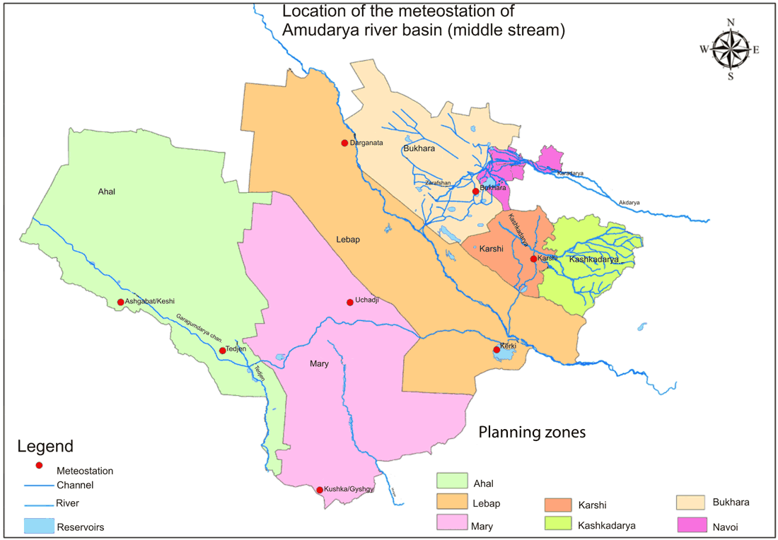
Location of meteostations in the middle stream of Amudarya
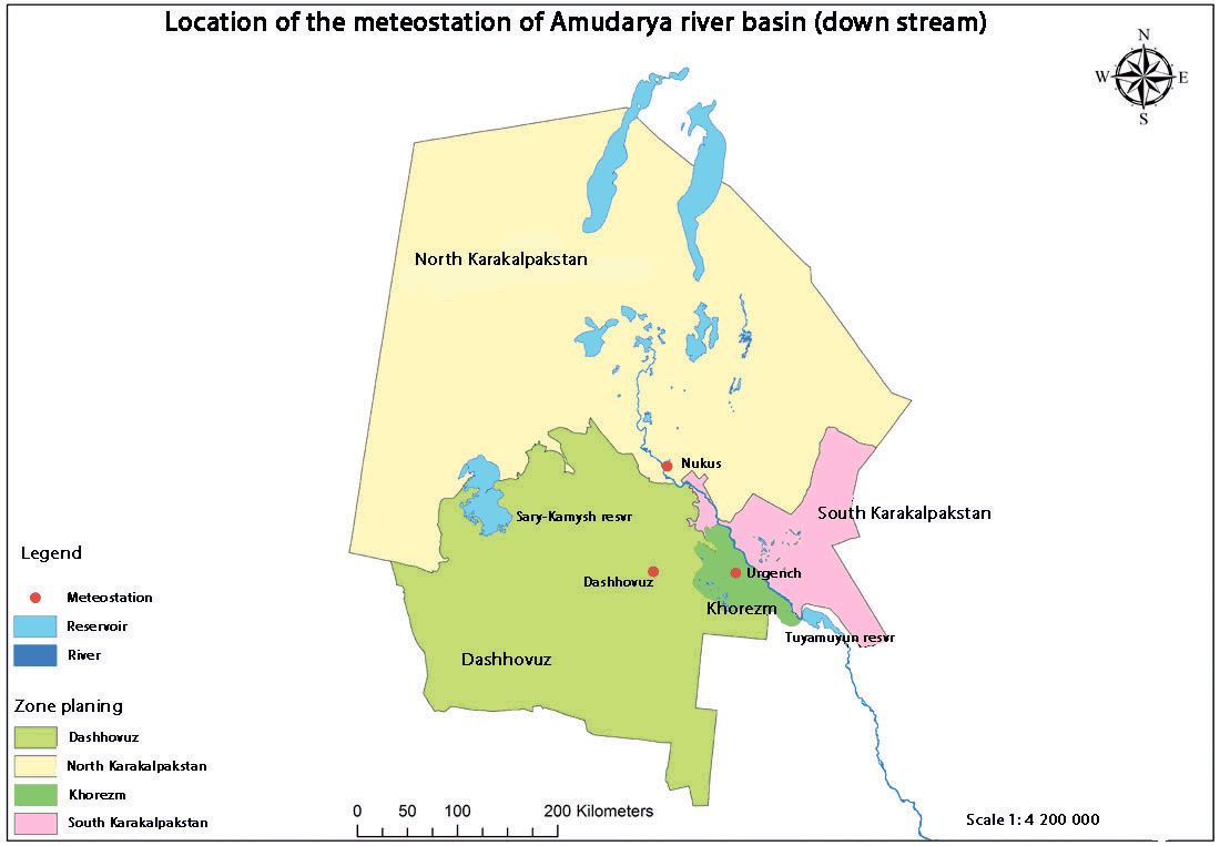
Location of meteostations in the downstream of Amudarya