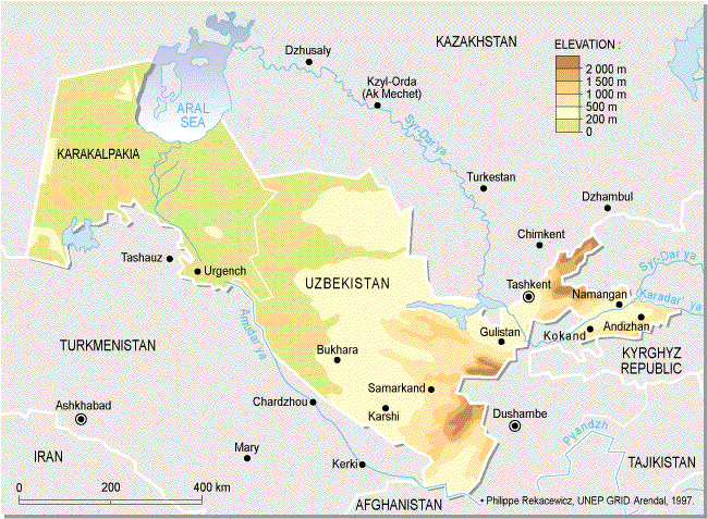
Republic of Uzbekistan
Climate of Uzbekistan is extremely continental. In a zone of deserts and steppes covering all plain area, winter is short, snow is not enough, and it thaws quickly, but summer is hot, dry and dusty. The average temperature in January is from -10°С in the north up to 0°С in the south, in July it is from 26°С in the north up to 32°С in the south. Precipitation in the territory of Uzbekistan is distributed irregularly because of location of the republic in the depth of the wide continent, big variety and complexity of its relief. The western plain and the Fergana valley are the most dry zones with 100 -300 mm of precipitation per a year. From plains to foothills there is more of precipitation. And on the western and southwesten slopes of the mountains open to the humid air mass there may be more than 2000 mm of precipitation per a year. The most humid seasons are spring and winter.
The share of spring precipitation makes up about 40 % of an annual amount, and in some mountainous areas - even much more.
The autumn precipitation changes between 10 and 20 % per a year.
Source: GRID-Arendal
Water resources
The main rivers of Uzbekistan are the Syrdarya and the Amudarya. Their largest inflows are the Sokh, the Chirchik, the Syrkhandarya, the Sherabad. Besides, the Zarafshan and Kashkadarya rivers are running there in the Amudarya basin but their waters do not flow into it. The rivers are formed by thawing snow in mountains. There are few lakes and they are small-sized: their total area does not exceed 0,5 sq. km. The most part of these lakes is in mountains at a 2000-3000 meter height.
In Uzbekistan there are also the man-made lakes - water reservoirs. The largest among them are Andizhan, Kayrakum, Kattakurgan, Charvak, Chardara.
Water resources of the rivers of the Aral Sea basin make up 110-120 cubic km. In case of rational consumption of this water it is possible to irrigate 4,8 million hectares of lands, but it is hardly enough to irrigate 4,2 million hectares.
It is caused by:
- large-sized specific charges in irrigation and washing of fields,
- poor quality of the irrigation systems,
- prevalence of a water-capacious method of irrigation by furrows,
- water pollution.
The total water consumption in the republic makes up 62-65 cubic km and about 36 cubic km out of them are taken from the main watercourses of the Amudarya and the Syrdarya. The deficiency (26-29 cubic km) is compensated at the expense of small rivers, underground sources as well as re-use of waste collector-drainage water (CDW).
The water economy of the republic is a complex engineering system which includes a ramified network of irrigation channels of 171 thousand km length, 53 water reservoirs with the capacity of 16 billion cubic meters, or 16 cubic km.
Water reservoirs allow to ensure the sustainable water delivery annually to all water-consumers independently from water quantity, to regulate the flows of the most part of rivers.
Underground water are used as a reliable source of drinking water for the needs of population, irrigation, watering and other industrial needs. Their stocks are replenished by filtration of the atmospheric precipitation, losses of water of rivers and irrigation system. In its turn, it has brought to reduction of a surface flow. Presently, their intake makes up already more than half of the prognosis and is still increasing.
Mountain water-courses and reservoirs are the cleanest one with low mineralization of water. They are considered as basic.
Water objects of the foothill zone and places of rest are mild contaminated. Organic and mineral substances are contained in their water in little quantities
In density populated zone (mouths of the rivers, lakes as well as collectors of the old irrigation zone ) the water objects are contaminated not very much. The contents of mineral and organic substances, heavy metals, mineral oil, pesticides is higher by 2-3 times in comparison with basic.
The collector-drainage network is considerably polluted in a zone of farmland with high soil salinity where the mineralization of water is higher in comparison with the standard norms by 3-5 times. The contents of biogenic mineral, organic substances, mineral oil and heavy metals by 3-5 times is higher than standard norms.
Polluted and extremely polluted water-courses and reservoirs are in density populated industrial cities and around the large settlements. Concentration of heavy metals here is by 10-15 times higher than standard norms, and sometimes - by 40-50 times.
In the Amudarya basin there is irrigated more than 2 million hectares of lands.
25,636 cubic km a year are used for the needs of various branches of national economy, more than 95 % of them - for irrigated agriculture.
The reserves of underground water in the Amudarya basin make up 29,032 thousands of cubic meters a day. For municipal-drinking and industrial water supply, for irrigation and other needs it is spent 32 % out of the authorized reserves annually.
The Syrdarya river basin is located in the territory of Kyrgyzstan, Tadjikistan, Uzbekistan, Kazakhstan. By its length ( 2137 km) the Syrdarya is the largest river of Central Asia and by its water area it concedes only to the Amudarya.
The Syrdarya is formed by the merge of the Naryn and Charadarya rivers in the eastern part of the Fergana Valley. In the Syrdarya river basin there are 6 provinces of the Republic of Uzbekistan: Andizhan, Namangan, Fergana, Tashkent, Dzhizak and Syrdarya.
The greatest number of its inflows are in the Fergana Valley. After the Fergana Valley the large rivers of Angren, Chirchik, Keles and Arys (Kazakhstan) inflow to the Amydarya river. Water resources of the Syrdarya basin make up 36,0 cubic meters a year among them the own resources of Uzbekistan - 8,0 cubic meters a year.
In terms of water availability the Syrdarya is the second most important river in Central Asia but the largest in terms of length. From the Naryn headwaters its length is 3019 km, with a catchment area of 219 thousands km2. Its headwaters lie in the Central (Interior) Tien-Shan mountains. The river is known as the Syrdarya after the point where the Naryn joins with the Karadarya. The river has glacial and snow feeding, with a prevalence of the latter. The water regime is characterized by a spring-summer flood, which begins in April. The largest discharge is in June. About 75.2% of the Syrdarya run-off originates in the Kyrgyz Republic. The Syrdarya then flows across Uzbekistan and Tajikistan and discharges into the Aral Sea in Kazakhstan. About 15.2% of the flow of the Syrdarya is formed in Uzbekistan, about 6.9% in Kazakhstan, and about 2.7% in Tajikistan.
Regulation flow in water farming system of Syrdarya carry on by 13 water reservoirs with common capacity of 35.0 km3 and useful 27 km3.
The large basin water reserves may hold almost all annual flow. The Uzbekistan’ water reserves make up about 5 cubic km.
In the middle and lower part of basin there are salty lakes which were formed in result of the collector-drainage water dumping. The largest lake of Ajdarkul (11,6 cubic km) is located in Uzbekistan.
Land resources
The plain part of Uzbekistan is a zone of deserts. The soil here is gray-brown, sandy, and in places near the subsoil water - grassland, marsh and saline. In mountainous areas of Tian-Shan and Pamir-Alau the wet of soil increases in the foothill plains with its height; the concentration of humus increases, salinity decreases and its quality varies.
In the foothill plains, foothills and low mountains the soil is sierozem, in middle mountains - brown soil, in high mountains - grassland soil.
Besides, there is a special group of irrigated lands: hard clay-oasis, sierozems-oasis, grassland-oasis. The irrigated lands provides 98 % of all production of agriculture.
At the end of the 20th century there was a general development of new lands caused by orientation to the cotton-crops growing. Thus, the salted, with low production lands were developed.
By 1990 the area of the irrigated lands has increased by 1,6 times, as much as the agriculture production has increased. The long-term cultivation of a monoculture of cotton constrained the crop rotations introduction that has resulted in decrease of efficiency of the irrigated lands. The concentration of humus in soil which is a basis of productivity, has decreased for the latest decades by 30-40 %. Lands with low and very low concentration of humus occupy about 40 % of all irrigated lands.
The total area of land resources of the republic is about 450 thousand sq. km., 61,5 % of it are used in agriculture, 3,6 % are occupied with forests, 2 % - especially protected areas, about 7% are city settlements, industrial enterprises and transports.
In agriculture more than 225 thousand sq. km. of the lands are used for the needs of life-stock-raising (a pasture, hay-mowing), more than 35 thousand sq. km. under the arable lands, about 43 thousand sq. km. of it are the irrigated lands.
There is a high concentration of DDT in soil tests. DDT was prohibited in 1983 despite the favorable climatic conditions for its decomposition. The soil pollution by DDT is not changed actually and exceeds the standard norms by 3-5 times.
In autumn, after cropping the cotton, there is found chlorine magnesium in soil in concentration exceeding standards for leaves moving off (defoliation). The areas of more than 80% of lands are polluted exceeding the standard norms.
High concentration of heavy metals is found in the soil around the developed industrial cities: Tashkent, Almalyk, Bekabad, Chirchik.
Contamination of various plots in the Samarkand province with arsenic and zinc exceeds the standard norms by 6 times.
The local soil contamination around the former aerodromes of agriculture and storages of chemical poison provokes a special anxiety.
During the last years the work on improvement of quality of areas under the crops and the humus concentration in soil is carried out.
Since 1991 the new lands' development has been sharply reduced because of the deficiency of water resources. The share of cotton crops has decreased but they began to sow grain and forage crops much more. The crop rotation and biological methods of plants protection are inculcated and the mineral manures are replaced by organic where it is possible. As a result, the soils in the Bukhara, Kashkadarya, Samarkand and Tashkent provinces have been improved.
|