|
|
DATABASE OF THE CHIRCHIK-AKHANGARAN-KELES
SUB-BASIN’S INTEGRATED MODEL
The database on water resources has been designed to store initial information necessary for hydrological model calculations.
The database contains the following information objects:
Point objects
- Gauging stations
- River and canal escapes
- Escapes for industrial and municipal wastewater
- Head water intakes at canals
- Hydroschemes
- Hydro power plants
- Thermal power plants
- Reservoirs
Linear objects
Areal objects
- Planning zones (districts)
- Flow formation zones (sub-basins)
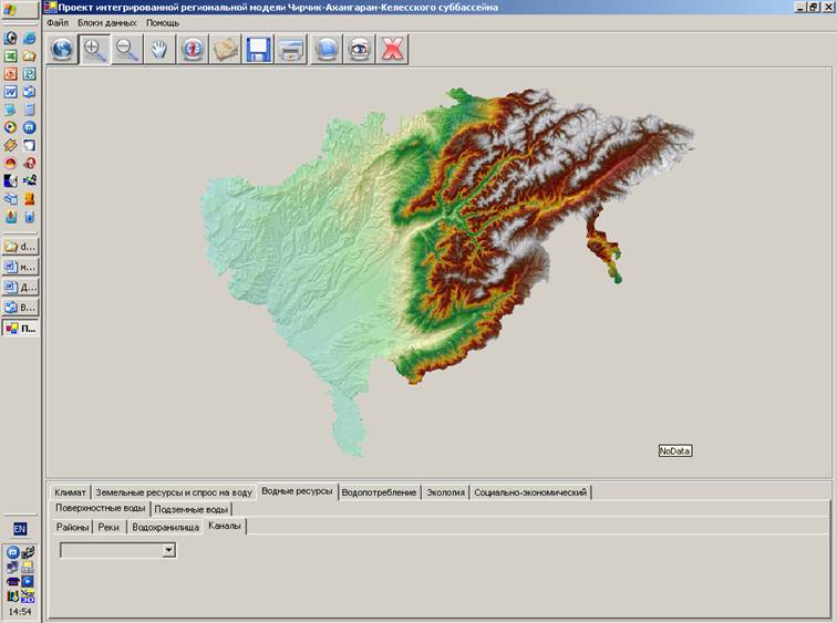
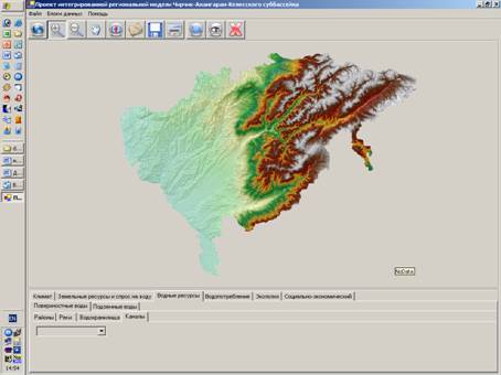
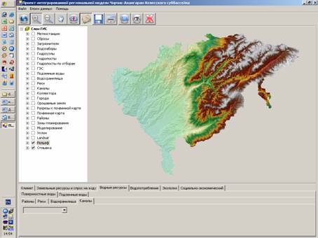
Main window
Option activated “View layers”
The key parameters
1. Hydrological and water-management information, energy sector
- River runoff and its salinity,
- Discharge from canals into rivers and idle discharge,
- Discharge into rivers and reservoirs from collectors (from irrigated land, with refer-ence to PZ and irrigation systems), household and domestic waste discharge (cities, villages), industrial wastes, salinity of waste discharges,
- Transfer flow at PZ boundaries – main canals and collectors (points of water trans-fer),
- Withdrawals from rivers and reservoirs,
- Reservoir operation regimes – water level, water volume and salinity at the begin-ning and the end of month, inflow, withdrawal and releases from reservoirs,
- Groundwater – usable groundwater resources, groundwater inflow and outflow, dis-charge, filtration losses in rivers and reservoirs, abstraction from groundwater sources per user,
- Water distribution:
- Uzbekistan – total, including from: Chirchik, Akhangaran, small rivers (Ugam, Ak-tash, Aksakata),
- Kyrgyzstan (Chatkal River),
- Kazakhstan (VDK, etc.),
- Uzbekistan’s irrigation systems (Tashkent main canal, “Bozsu” system, “Parkent-Karasu” system, “Akhangaran-Dalverzin” system) – irrigated farming, agricultural water supply, fishery,
- Urban and industrial centers (Tashkent, Chirchik, Yangiyul, Almalyk, Angren) – household-drinking needs, industry (Chirchik chemical plant, Almalyk industrial system, Angren coal open-pit mine),
- Internal use (with reference to irrigation systems): groundwater, CDW.
- HEPS parameters: gross and net storage volume of reservoirs, highest controlled water surface, maximum water surface, water head in HEPS under the highest con-trolled water surface and dead-storage level, HEPS capacity, installed power.
- Limitations:
- Recreation demand – minimum level of Charvak reservoir drawdown (summer, winter),
- Limitations for Charvak reservoir regarding seismicity – filling below the set level,
- Limitations for Charvak reservoir regarding non-admission of dust storms – draw-ing off not below the set level,
- Environmental demand for runoff: minimum flow along Chirchik river downstream of Charvak reservoir.
- Heat-power engineering – operation parameters and requirements of State rayon power stations.
2. Land resources and their use
- Land fund (arable land, perennial plants, fallow land, hayfields, pastures, agricultural land, other lands),
- Irrigated areas – total, including sources: river intake (transboundary flow, main riv-ers), sai, springs, wells, collector-drainage water (CDW),
- Area under drainage, drainage modulus,
- Distribution of areas per soil salinity, groundwater level and salinity, index of soil quality,
- Cropped area, including non-irrigated, cropping patterns and crop yields,
- Agricultural production in irrigated and dry lands (seeding dates, cultivation dates, gross harvest).
3. Ecology
- Water quality:
- Physical and chemical characteristics,
- Salinity and main ions,
- Biogenic elements,
- Organic matter,
- Heavy metals.
- Parameters of ecological hydroecosystem assessment,
- Parameters of ecological landscape (natural, agricultural) assessment,
- Parameters of anthropogenic load on ecosystems and evaluation of load conse-quences (irrigated agriculture, livestock, fishery, industrial and municipal enterprises, etc.).
4. Socio-economic parameters
- Operational costs and net cost:
- Costs of crop production per variety: total; machinery; labor costs; seeds; fertil-izer; fuel; other; administration; depreciation charges,
- Water and agricultural output prices
- Purchasing and market prices of agricultural output,
- Productivity:
- Irrigation water per irrigation system,
- Industrial water use (per plant),
- Household and drinking water use,
- Demographic and macro-economic indicators
- Population trends, including urban, working population, occupied in economy and agriculture,
- Industrial production volume,
- Agricultural production volume,
- Investments,
- GDP, industrial and agricultural shares,
- Population income,
- Water use norms – for crops, household and drinking water supply,
- Production volumes:
- agriculture,
- fishery,
- livestock,
- output of livestock farming,
- allied industries,
- power sector, including hydropower,
- industry,
- Recreation and tourism
5. Climate data
- Temperature, precipitation, evaporation, relative humidity (per weather station).
|